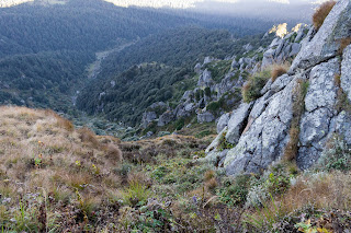
Sirmaur, Himachal Pradesh
One of the natural treasures of Himachal Pradesh, Sirmaur is known as a bowl of Peach (fruit). Located in the southeast of the state, this site was established in 1090 AD by King Rasalu of Jaisalmer. During the British period in India, this region has remained a princely state. At present Sirmaur is counted as one of the most special tourist destinations in Himachal Pradesh with its various natural sites. With the Himalayan landscape, Sirmaur invites all kind of tourists to come here. The friendly atmosphere here is considered ideal for a pleasant holiday.There are six tehsils in this district as Nahan, Renuka, Paonta Sahib, Rajgarh and Shillai. The Giri River divides this district into two equal parts that is Giripar and Giriwar.
➤Main Places of Interest in this Sirmaur district:
➥Churdhar
You can start the journey of Sirmaur from the religious places here. Located at an elevation of 3,647 meters above sea level, it is one of the highest peaks in the state. This hill top is a holy place which is considered to be one of the most important pilgrimages of Lord Shiva. According to old belief, it is the hill place of the peacocks from where Lord Hanuman went to bring sanjeevini booti. Therefore, the religious significance of this mountainous site increases. Even today, this Himalayan spot is known for its herbal characteristics. This is the must visit place at Sirmaur.
➥Renuka ji
If you wish, after the tour of Churdhar Mountain, you can plan a trip to ancient Renuka ji. Renuka Lake is one of the most popular destination of pilgrimage sites in Himachal Pradesh, where devotees and tourists can be seen daily. You can see the different flora and fauna species here. Various festivals are organized here during Kartika Ekadashi in the Hindu Calendar.➥Haripur
In the historic sites of Sirmaur, you can plan a trip to Haripur. Located at an elevation of about 687 meters above sea level, Haripur is known for its mountain of Haripur Dhar. The ancient fort built on the hill also attracts the tourists to a great extent. This fort was constructed by Sirmaur rulers. From this fort you can enjoy the natural beauty of the city. Haripur is also known for various adventure activities. Here you can take the exciting experience of trekking. Apart from this, Haripur is also quite famous as a religious place. Here you can visit Maa Bhangayani temple.➥Habban Valley
In addition to the above locations, you can plan a trip to the Hubban Valley. The Hubban Valley is known for its various temples and a culture completely different from the modern city life style. Most of the temples built here were built by the Rajput rulers. The famous temples here include Shirgul Maharaj Temple and Kali Maa Temple etc.➤Best time to visit Sirmaur:
You can visit this place throughout the year but the best time to visit is from late September to mid November as climate is very pleasant at this time.➤How to reach Sirmaur district:
➥Tourists can reach here by road. This district is 90 kilometres from Chandigarh and Dehradun & 135 kilometres from Shimla.➥You can also reach here via Train. Nearest Railway station is Barog near Kalka which is 42 kilometres away. Ambala (100 km) and Dehradun (65 km from, Paonta Sahib) railway stations are also close to this district.
➥The closest airports are Chandigarh and Dehradun from here tourists can hire a cab to reach this district.
If you want to know more information about this district then you can visit their official website @https://hpsirmaur.nic.in/
Some images from this district:
 |
| Churdhar Sirmaur Himachal Pradesh India |
 |
| Churdhar Sirmour Himachal Pradesh |
 |
| Paonta Sahib Sirmaur |
 |
| Renuka Lake Sirmaur Himachal Pradesh |
 |
| Renuka Lake Sirmaur Himachal Pradesh |
Comments
Post a Comment